
Diamond Head & Kapahulu
Leʻahi’s iconic crater and a nearby loop of parks, streets, and local eats.
Good Fit For
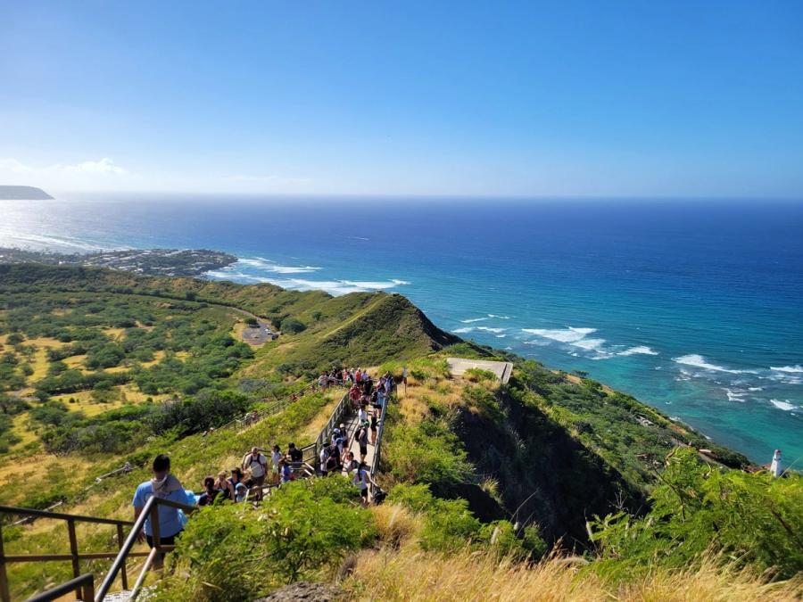
- Early-morning crater hike
- Park-edge strolling
- Casual food corridors
- Quick Waikīkī side trip
- Coastal drive views
Trade-offs
- Crowds near Leʻahi
- Limited parking pockets
- Traffic on Kapahulu
- Sun and little shade
Logistics & Getting Around
This is a compact east-of-Waikīkī circuit best done early, then linger along Kapiʻolani Park and nearby food streets. Most visitors arrive by rideshare, bus, bike, or a short drive; curbside parking can be scarce.
Nearby Areas in Honolulu
Ala Moana & Mōʻiliʻili
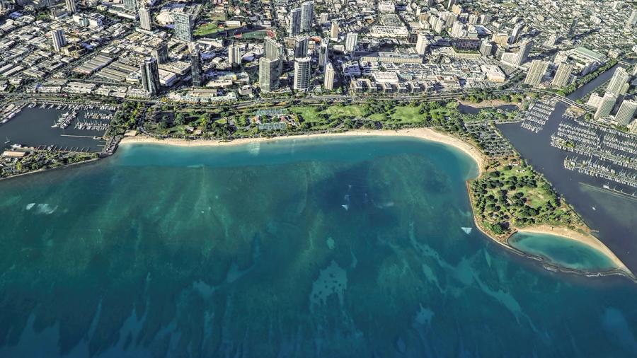
Urban Honolulu for shopping, quick meals, and easy access just west of Waikīkī.
Downtown, Chinatown & Kakaʻako
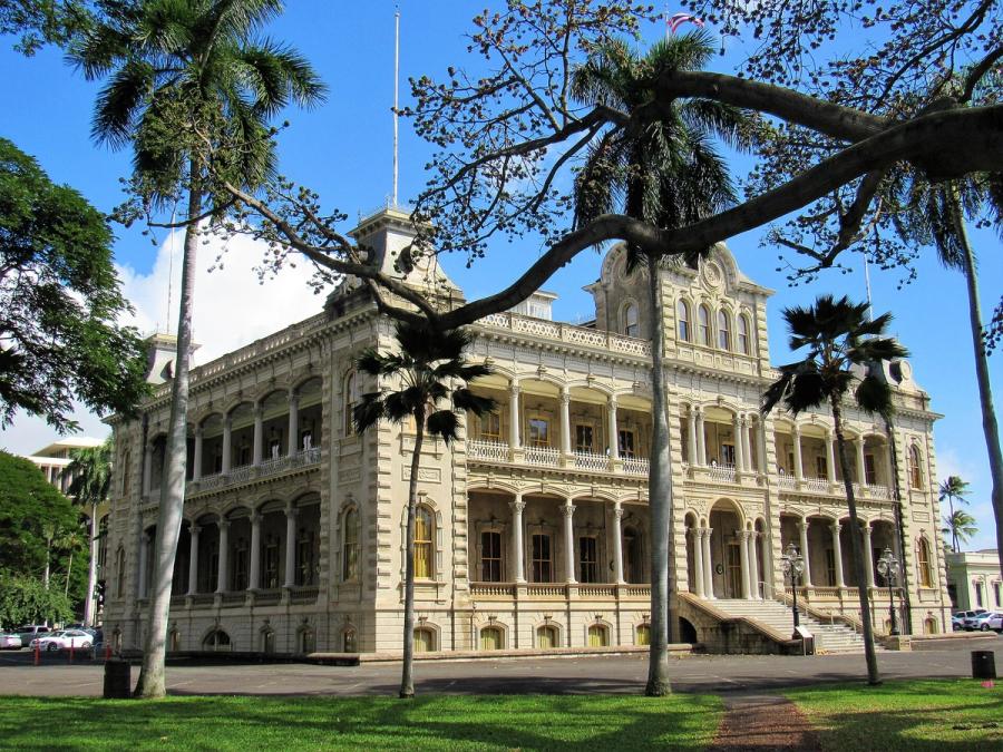
Honolulu’s urban core: palace-and-capitol history, Chinatown grit, and Kakaʻako’s waterfront remake.
Hawaiʻi Kai & East Honolulu
Southeast Honolulu’s scenic, suburban coast with iconic bays, craters, and quick stop-offs.
Kahala & Waialae
A calm, upscale stretch of east Honolulu coastline and neighborhoods beyond Waikīkī.
Kaimukī & Pālolo
Mauka Honolulu neighborhoods of ridges and valley streets just beyond the beach belt.
Mānoa, Makiki & Nuʻuanu
Honolulu’s green mauka valleys and ridgelines, close to town but quietly local.
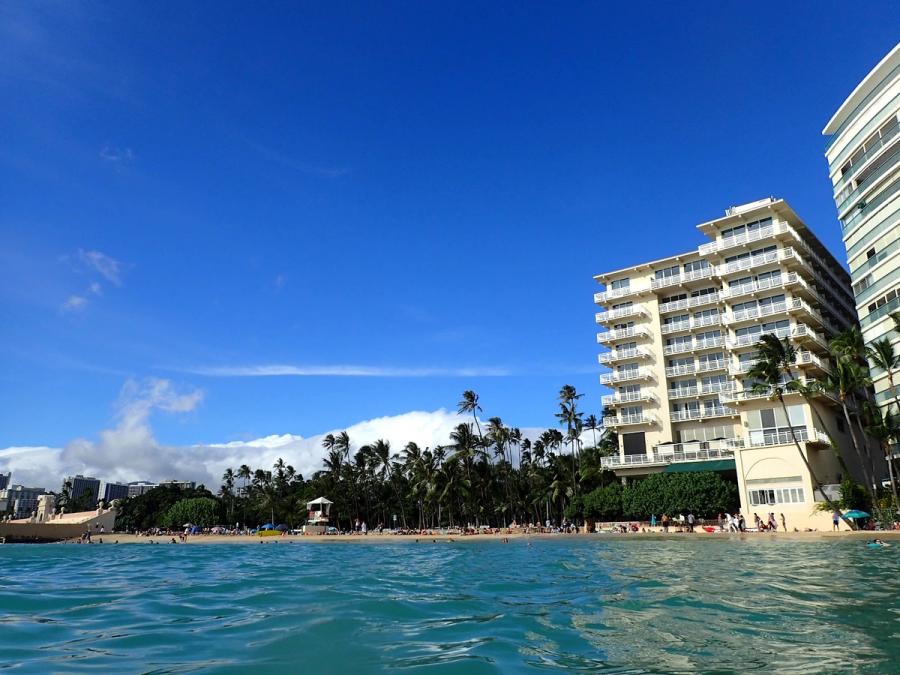
Waikīkī
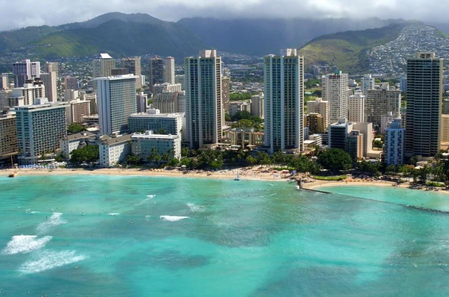
Honolulu’s iconic urban beach district: high-rises, a long sandy arc, constant motion.
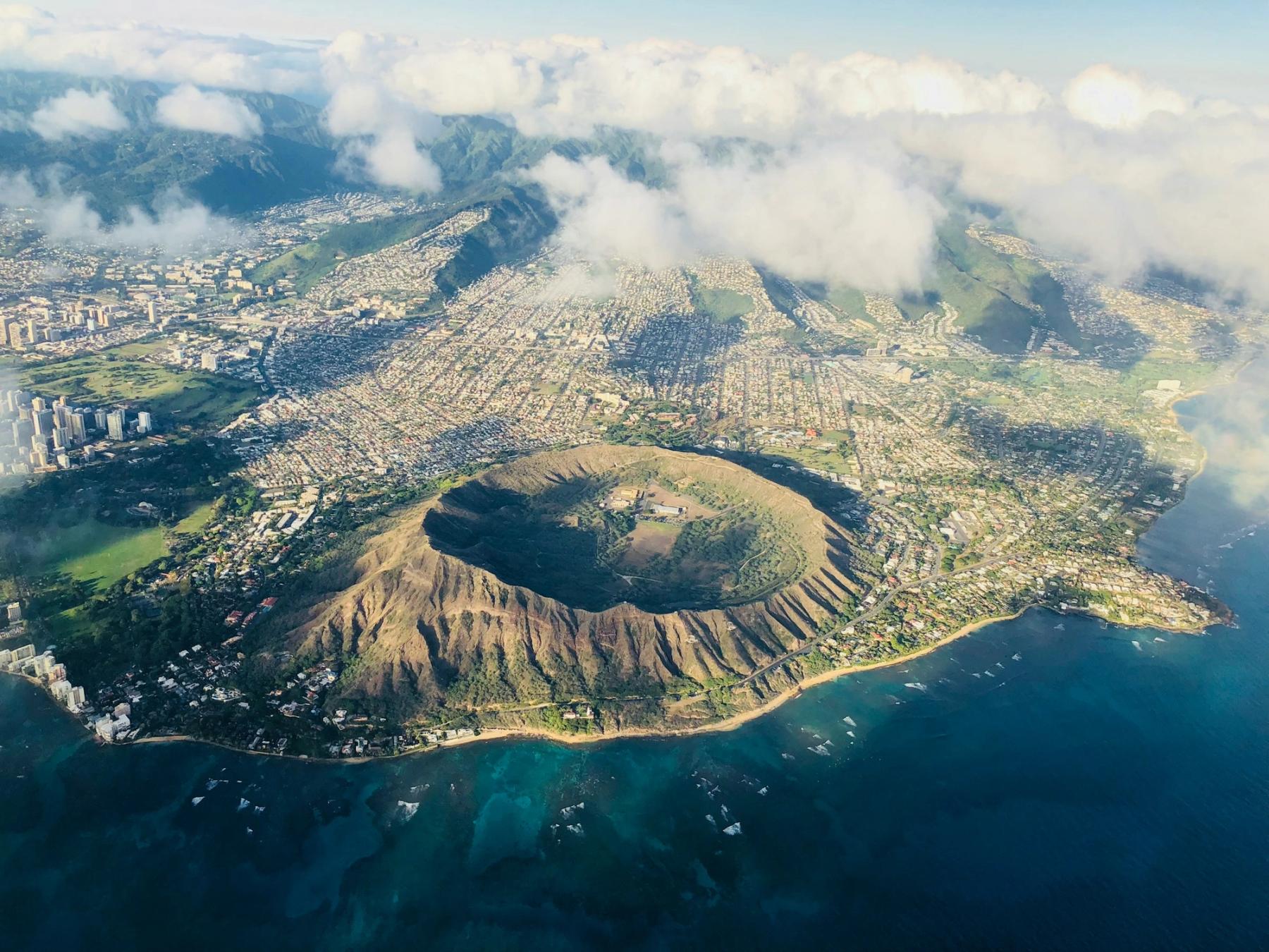
Signature Experiences in Diamond Head & Kapahulu
The feel: Honolulu’s everyday edge of an icon
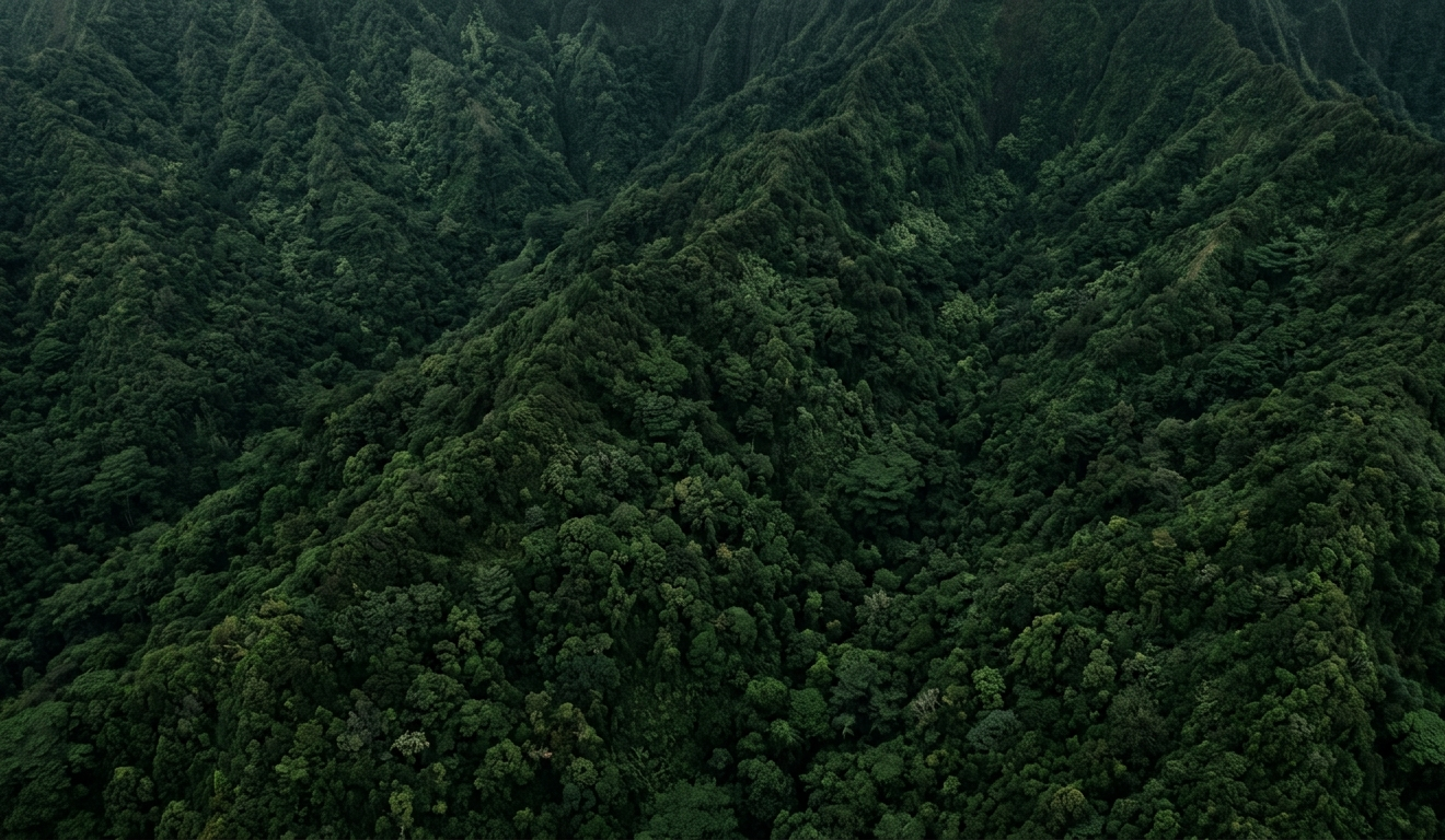
Diamond Head & Kapahulu isn’t a single attraction so much as a reliable loop: Leʻahi (Diamond Head) as the landmark, Kapiʻolani Park as the green buffer, and Kapahulu and Monsarrat as the streets where the day continues. It feels noticeably different from Waikīkī even though it’s next door—less resort strip, more neighborhood-in-motion. You’ll see runners and dog walkers in the park, surfers scanning the water, families doing errands, and visitors folding into the same sidewalks.
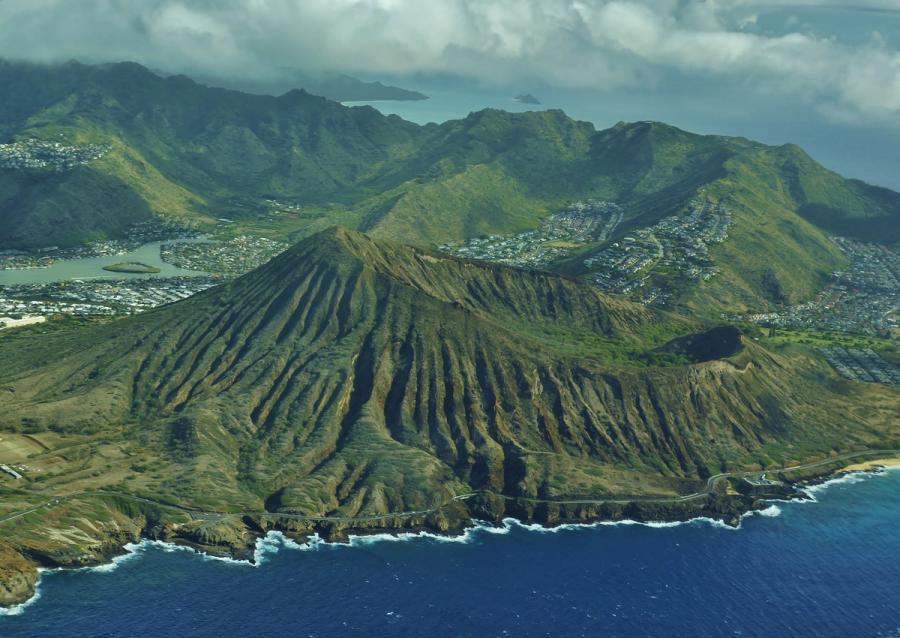
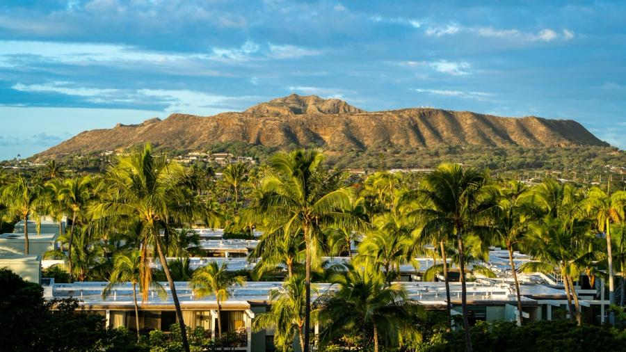
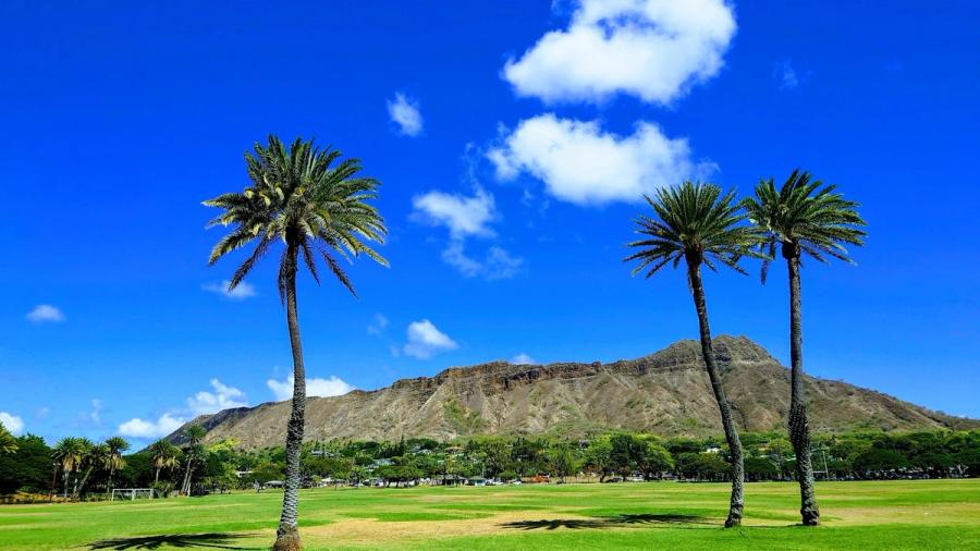
The landscape sets the tone. Leʻahi’s crater rim is close enough to dominate the skyline, and the coastal stretch along Diamond Head Road has that classic Honolulu contrast of volcanic slope, ironwood shade, and ocean glare. It’s scenic, but it’s also urban: narrow streets, crosswalk waits, and the occasional bottleneck when everyone arrives at once.
How people typically spend time here
Most visits hinge on the Diamond Head State Monument hike, often planned for earlier in the day when conditions are cooler and views tend to be clearer. The payoff is broad, map-like perspective—Waikīkī’s curve, the city grid, and the long line of shoreline toward Hawaiʻi Kai.
Afterward, the area naturally shifts into a slower rhythm. Kapiʻolani Park is where people decompress—open lawns, big monkeypod trees, and a breezy edge where the city feels less compressed. From there, Kapahulu and Monsarrat make sense as “keep it simple” streets: cafés, plate-lunch counters, bakeries, and small shops that feel lived-in rather than curated.
KCC (Kapiʻolani Community College) is another familiar waypoint in this cluster—less a destination in itself than a recognizable landmark that helps orient you when you’re moving between the crater, the park, and the food corridors.
Practical notes and honest tradeoffs
This pocket rewards walking and short hops, but it isn’t a single pedestrian zone; sidewalks widen and narrow, crossings can be busy, and midday sun is real. Driving can be convenient, yet parking is often the limiting factor.
Overnight stays aren’t the main story here—most travelers fold Diamond Head & Kapahulu into a Waikīkī or broader Honolulu day. That’s usually ideal: you get the views, the park, and the food streets without trying to make a small, high-traffic visitor circuit do the job of a full neighborhood base.

Can't decide where to stay? Get personalized advice.
Custom recommendations built from the web's most comprehensive Kauai guide.