
What it is
The Keālia Trail is a popular hiking and mountain biking route located on the North Shore of Oʻahu, within the Kuaokala Forest Reserve in the Waialua and Mokulēʻia area. It is part of the statewide Na Ala Hele trail network, managed by the Hawaiʻi Department of Land and Natural Resources (DLNR). The trail is approximately 7 to 7.4 miles out-and-back and is generally rated as moderate in difficulty.
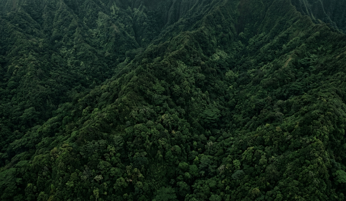
The initial portion of the trail features about 19 switchbacks that ascend a pali (cliffside), offering expansive views of the Mokulēʻia coastline, Dillingham Airfield, and the North Shore. After reaching a picnic shelter at the top of these switchbacks, the trail transitions into a dirt road (Keālia Road), which can extend further inland through a mixed forest, eventually leading to potential views of Makua Valley or connecting to the Kuaokalā Trail. The trail is also known for native plant species like Wiliwili trees in their natural habitat.
Visitor experience
Travelers choose Keālia Trail primarily for its panoramic views of Oʻahu's North Shore and the remote Waiʻanae Mountain Range. The ascent via numerous switchbacks provides continuously improving coastal vistas and the sight of gliders soaring from Dillingham Airfield. Beyond the initial climb, the trail continues along a dirt road through a cooler, forested environment of gum and pine trees, offering a distinct contrast to other tropical Oʻahu hikes.
The trail is suitable for various visitor use cases. A shorter, family-friendly option involves hiking to the picnic shelter at the top of the switchbacks, which is about 1.5 miles up (3 miles roundtrip) with around 1,000 feet of elevation gain. This segment provides rewarding views without committing to the full distance. For more adventurous hikers, continuing along the dirt road offers a longer, more secluded experience, potentially reaching overlooks of Makua Valley. The trail is also popular for trail running and, for experienced riders, mountain biking, with some considering the downhill portion quite challenging.
Logistics
- Area: The Keālia Trail is located in the Waialua & Mokulēʻia area on Oʻahu's North Shore, roughly an hour's drive from Waikīkī. It offers a distinct escape from the more bustling areas of the island.
- Access: The trailhead is accessed via the west entrance of Kawaihāpai Airfield (formerly Dillingham Airfield) on Farrington Highway. Follow signs for Keālia Trail once inside the airfield.
- Parking: A designated parking lot is available within the airfield. It is crucial to note that the airfield gate is locked around sunset, typically around 6 PM, so visitors should plan to exit before this time.
- Reservations/Permits: No permit is required for hiking the Keālia Trail itself. If extending the hike to connect with certain sections of the Kuaokalā Trail or using some forest reserve access roads for 4-wheel drive, a day-use permit from the DLNR Division of Forestry and Wildlife (DOFAW) might be required. For hikers accessing Kuaokalā via Keālia, a permit is generally not needed.
- Timing: The trail is best visited during daylight hours, allowing ample time to complete the hike before the parking lot gate closes at sunset. Starting early in the morning is recommended.
- Likely duration: The full 7 to 7.4-mile out-and-back hike typically takes 3-4 hours. A shorter hike to the Keālia Shelter (picnic table) and back would be around 1.5 to 2 hours.
- Activity type: Depending on the chosen distance, Keālia Trail can be a half-day activity (to the shelter and back) or an anchor activity (for the full trail to Makua Valley overlooks).
Safety and cautions
- Trail conditions: The trail includes many switchbacks and can be steep in sections, requiring a good level of fitness. Portions of the trail run along cliff edges, so hikers should watch their footing. It can be muddy and slippery, especially after rain, with potential for many forks in the trail further inland.
- Weather: Exposed ridgeline sections can be hot and dry. Bring plenty of water, wear sunscreen, a hat, and sunglasses to protect against heat and sun exposure.
- Closures: Trails within the Na Ala Hele network, including Keālia Trail, are subject to temporary closures due to severe weather, landslides, or maintenance. For example, a landslide temporarily closed parts of the Keālia Trail in early 2026. Always check the DLNR Nā Ala Hele website for current conditions and closures before heading out.
- Cultural/Land-management: The trail is located within a forest reserve where permitted hunting of pigs and goats may occur. Staying on marked trails is essential for safety, environmental preservation, and cultural respect.
- Parking Gate: Be aware of the gate closure time at Dillingham Airfield, as vehicles left inside after sunset may be locked in overnight.
- Wildlife: Like all Hawaiian trails, watch out for invasive species and observe local fauna respectfully.
Editorial take
The Keālia Trail is an excellent choice for visitors to Oʻahu who are looking for a moderate to challenging hike with spectacular, unobstructed views of the North Shore and the Waiʻanae Mountains. It's particularly appealing to those seeking a less crowded experience than some of Oʻahu's more famous (and often illegally accessed) trails. It suits a range of hikers, from families looking for a rewarding shorter trek to the picnic shelter to experienced hikers and trail runners wanting a longer, invigorating workout.
Travelers who should prioritize this activity include:
- Hikers seeking panoramic coastal and mountain views.
- Families or those looking for a moderate, well-maintained trail with a clear turnaround point.
- Visitors staying on the North Shore or West Side of Oʻahu.
- Those interested in seeing native plants in their natural habitat.
Travelers who might skip it include:
- Those preferring completely flat or paved walking paths.
- Individuals with significant mobility limitations who would find continuous uphill switchbacks difficult.
- Visitors strictly interested in waterfall or dense rainforest hikes.
Do not confuse Keālia Trail with the infamous "Stairway to Heaven" (Haʻikū Stairs), which is illegal to access and heavily enforced. While Keālia Trail connects to the Kuaokalā Trail, the permitting and access for Kuaokalā can be more complex, particularly if attempting to access it from the Kaʻena Point Tracking Station side, which may involve military escort and permits. Hiking to Kuaokalā via Keālia generally avoids these permit hassles.
Source notes
- DLNR Na Ala Hele Website: https://dlnr.hawaii.gov/
- Hawaii Aloha Travel - Kealia Trail: https://vertexaisearch.cloud.google.com/grounding-api-redirect/AUZIYQGQrxeQmHLFvUrim3K4L18HVybXSbkQu21UBCqNcUvoeR_KFnysLb9n45fn6BjdQ3c4PKDFqqRfbi6CHuTeeOj79Uw6WlLzHMz_UHMiFMEkgASS0KtnSdBiEkxgvqGHH48a53c-eBMD_h9xn8Gy5e3SFdNPXP6wIVsq
- Noah Lang Photography - Hiking the Keālia Trail: https://vertexaisearch.cloud.google.com/grounding-api-redirect/AUZIYQH5mKh-_h4rDUdNdh9W9LMwxviZSZX9kmoZm7XtVoeswHqs70iOQakt7e44JVW80fqu8m1pbWgSIB10awYLtgYzZ9Tg5RZ9efQacOsER9wwn-Eyic4Id50T5puPBq1Lj9-ig9BNt55l3flpT_A3BUCnz8I6v0kv6Io=
- The Hiking HI - KEALIA TRAIL to MAKUA VALLEY: https://vertexaisearch.cloud.google.com/grounding-api-redirect/AUZIYQEQwhF7MWQbPdjo2jGkCK9gmLJSmVyCiDlef9dVPFALPA3rl-2WhI0GX_qdU_qURTNqsEQiExgchbs0X9AHovrWnq58GysrpJhBZo-0n_5RHqRuMvuWSO4XGx2PzzvnymLjy0-V0u_hQNLwWbyoBbdtTBBn2R1uL7nbJhk-RFnjY_w3
- The Cat Dish - Keālia and Kuaokalā Trails: https://vertexaisearch.cloud.google.com/grounding-api-redirect/AUZIYQGHcTGcaLPFxXmJwWIUGMPWavKj7fk7rwteTu0eWpOjFj5DkP6kCeW8x8QUBPIM2UDTlWcGZwiKhUM9e1J9GqFhyzLGJtNMMmnXjezRLfYvxVVpholl_9RajWDTNqdmWIpNW-A6KqGdABj_--OVEAFkbstN-pTdacmXmCzew94HCCtjtsb6_Zqh2yCp-bZa_CFD2ORb2zKbKdOhmQ==
- The Katie Show Blog - How To Hike The Kealia Trail: https://vertexaisearch.cloud.google.com/grounding-api-redirect/AUZIYQHZhQox9A-IA1rjuf3sWvE34CxrFOrvxbAxBcxhg6BHkZSJHbHfEX9Dega6CzA7l_WyQRWMNtxESaBHEZ1u0sDP1iJoVRMtRhpsv8tLRso-YMr6an5TRWmS6ki0N73sIS9yMQ6jrA==
- OuterSpatial - Keālia Access Road & Kuaokala Trail: https://vertexaisearch.cloud.google.com/grounding-api-redirect/AUZIYQE2V8C_LBwvRhvWfL3sU0JwP0idGhSVdf6s-IdnFL-ONfs9J8LyekZAnNzD-JrVWIDpt_vTyz8nBtAIHGEEBEhsgn4CzwlKYdvzwMhdbD-5BMOyMR6FY6nsxKNpXBLMbVhKv8oHU7ZSXV1PizXmK1VMXc6tCDwBwA==
